Posted in October 2019
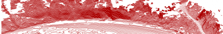
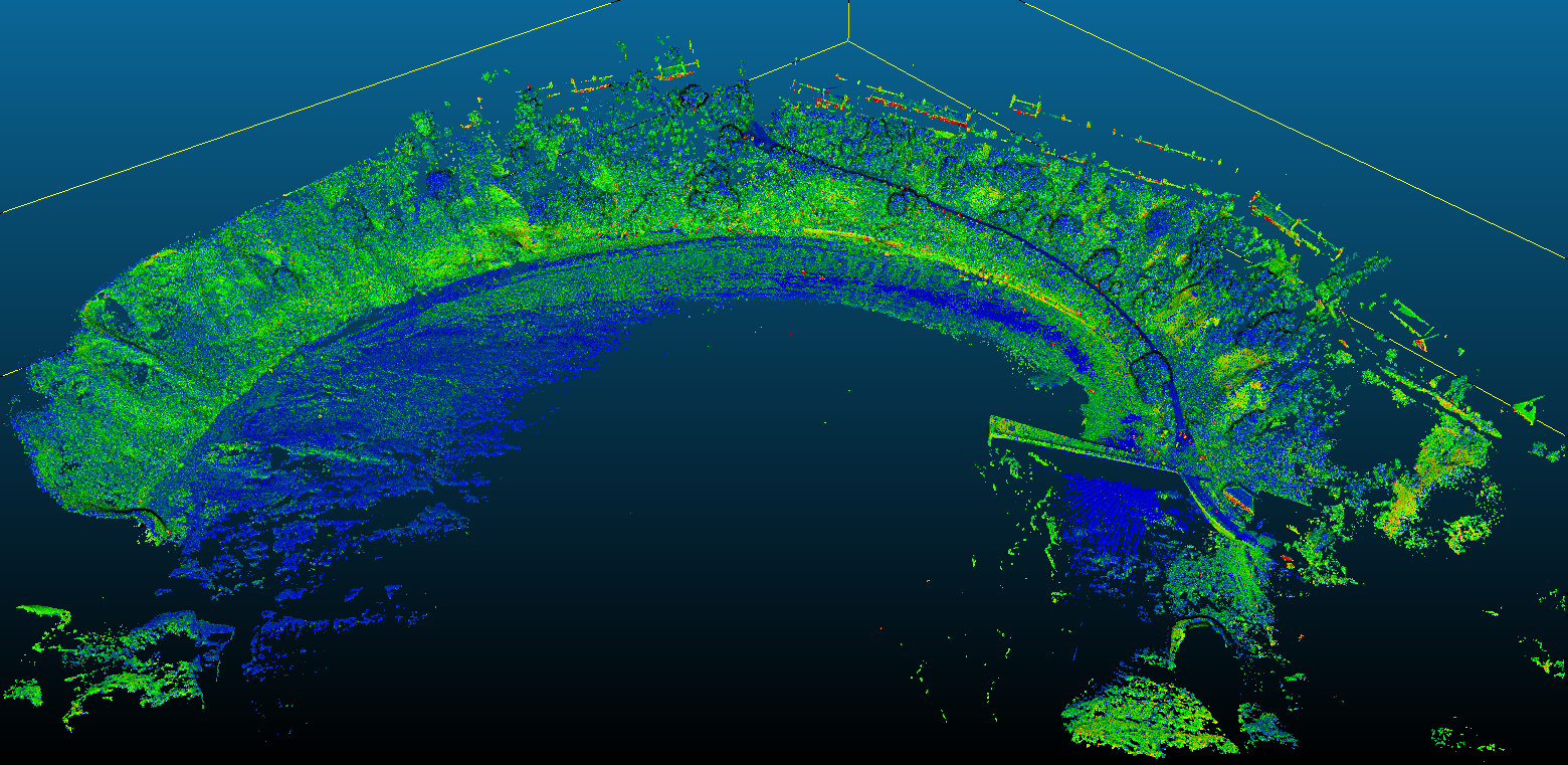
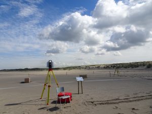
CoastScan – Monthly scan in Noordwijk
In support of the CoastScan project we go to scan the beach in Noordwijk in front of Huis ter Duin once per month with the Leica Laser Scanner of the OLRS group. We are especially interested in the parts of the beach just behind the dunes, that cannot be seen from the hotel due to the shadows of the dunes.
- Location: Noordwijk, NL
- Object: Beach, dunes, beach café and Hotel Huis ter Duin
- Associated project: CoastScan
- Number of scans: 3-7 per scan day
- Location on Bulk drive: /tudelft.net/staff-bulk/citg/grs/OLRS/LaserScanner/CoastScan/CoastScan_YYYYMMDD
- Contact person: Mieke Kuschnerus
- Dates (once per month, August 2019 – October 2021):
- 22/08/2019
- 19/09/2019
- 24/10/2019
- 22/11/2019
- 19/12/2019
- 30/01/2020
- 04/02/2020
- 14/02/2020
- 25/02/2020
- 04/03/2020
- 14/03/2020
- 24/03/2020
- 01/04/2020
- 09/04/2020
- 17/04/2020
- 24/04/2020
- 27/05/2020
- 25/06/2020
- 30/07/2020
- 27/08/2020
- 30/09/2020
- 27/10/2020
- 27/11/2020
- 28/12/2020
- 29/01/2021
- 24/02/2021
- 13/04/2021
- 31/05/2021
- 15/07/2021
- 26/08/2021
- 01/10/2021 (+ extra scan of helicopter landing platform)
Catterline Bay (Aberdeenshire)
- Location + Date: Catterline Bay (Aberdeenshire, Schotland), 2019-10-16 (access road) & 2019-10-17 (beach).
- Object: Focus on coastal geomorphology and erosion, including two detailed scans of implemented mitigation measures.
- Associated project: OPERANDUM
- Number of scans: 29 registered scans and two detailed scans of mitigation measures.
- Location on Bulk drive: /tudelft.net/staff-bulk/citg/grs/OLRS/LaserScanner/20191016_Catterline
- Contact person: Adriaan van Natijne
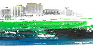
ShoreScape Experiment in Monster
ShoreScape experiment during second scan day.
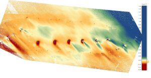
Point cloud colored according to elevation around boxes, which were placed on the beach for the ShoreScape experiment.
For the ShoreScape experiment in April/May 2019 wooden boxes were placed on the beach at different heights. The area around the boxes was scanned from different location on the first day of the experiment, after 3 weeks and after 6 weeks to observe sand accumulated due to aeolian sand transport around the boxes.
- Location + Date: beach close to Monster, NL (just south of the zandmotor), April/May 2019
- Object: Beach with wooden boxes and deformations due to aeolian sand transport
- Associated project: CoastScan/ShoreScape
- Number of scans:
– 4 scans on the first day (07/04/2019)
– 6 scans on the second day (26/04/2019)
– 7 scans on the third day (13/05/2019) - Location on Bulk drive: /tudelft.net/staff-bulk/citg/grs/OLRS/LaserScanner/ShoreScape_201904
- Contact person: Mieke Kuschnerus
OLRS Laser Scan Projects
Please report in this blog your Terrestrial Laser Scan project. Provide for each scan project the following information:
- Location + Date
- Object, e.g. bridge, city hall, trees,…
- Associated project, if any
- Number of scans
- Location on Bulk drive where data is stored
- Contact person
- One image of the data set, like a screenshot
Please make sure that the name of the folder on the bulk drive is descriptive and contains an indication of a date (month/year).
Please upload to the bulk drive:
– raw project data as exported from the scanner
– files converted into readable format (e57/xyz/asc/las)
– project file after registration in cyclone
Thanks in advance!
Links to OLRS public data:
Oude kerk, Delft
Constructiebrug, Delft
Trambrug, Schipluiden
Molen de Roos, Delft
Morspoort, Leiden
Maison d’Artiste, Delft
St.-Bavokerk, Haarlem
————————————————————————————————–