OLRS Laser Scan archive
OLRS Laser Scan Projects
Please report in this blog your Terrestrial Laser Scan project. Provide for each scan project the following information:
- Location + Date
- Object, e.g. bridge, city hall, trees,…
- Associated project, if any
- Number of scans
- Location on Bulk drive where data is stored
- Contact person
- One image of the data set, like a screenshot
Please make sure that the name of the folder on the bulk drive is descriptive and contains an indication of a date (month/year).
Please upload to the bulk drive:
– raw project data as exported from the scanner
– files converted into readable format (e57/xyz/asc/las)
– project file after registration in cyclone
Thanks in advance!
Links to OLRS public data:
Oude kerk, Delft
Constructiebrug, Delft
Trambrug, Schipluiden
Molen de Roos, Delft
Morspoort, Leiden
Maison d’Artiste, Delft
St.-Bavokerk, Haarlem
————————————————————————————————–
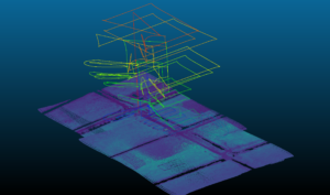
TLS P40 scans, Stairwell, Stedelijk Museum, Amsterdam
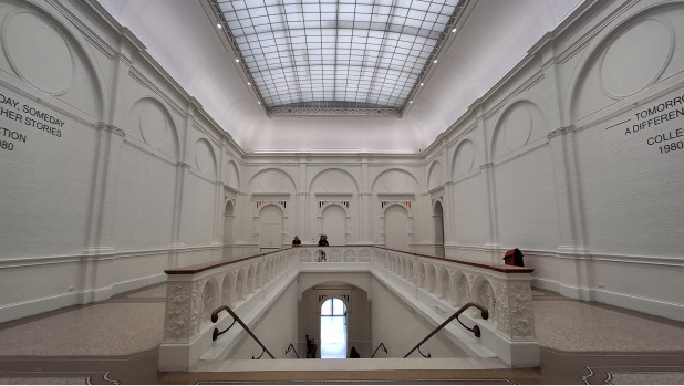
Scans around the stairwell on the 1st floor of the Stedelijk Museum, Amsterdam, were acquired in September 2024 to enable the creation of a 3D model
staff-bulk/citg/grs/OLRS/LaserScanner/202409_Stedelijk_museum_amsterdam/
TLS Leica P40 scans, Nieuwe Kerk, Delft
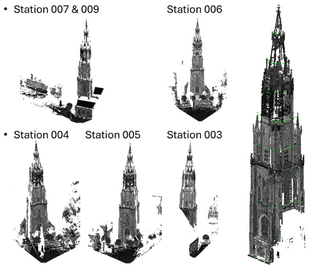
Scans of the tower of the Nieuwe Kerk church acquired on September 24, 2024
staff-bulk/citg/grs/OLRS/LaserScanner/NieuweKerk_240924
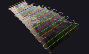
TLS Scans, tree health experiment, Green Village
staff-bulk/citg/grs/OLRS/LaserScanner/Treehealth25092024
staff-bulk/citg/grs/OLRS/LaserScanner/treehealth210525
Three trees in the green village undergo different treatment. Analyzing point cloud derived metrics is one way to evaluate the effect of the different treatments. Point clouds were acquired so far on September 25, 2024 and May 21, 2025.
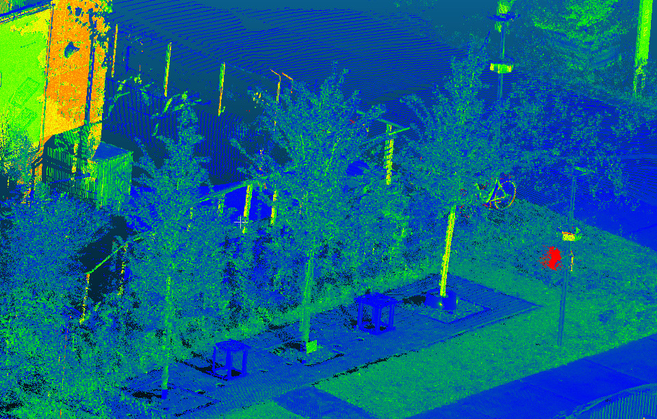
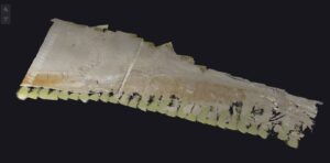
TLS scan of trees and talud at green village
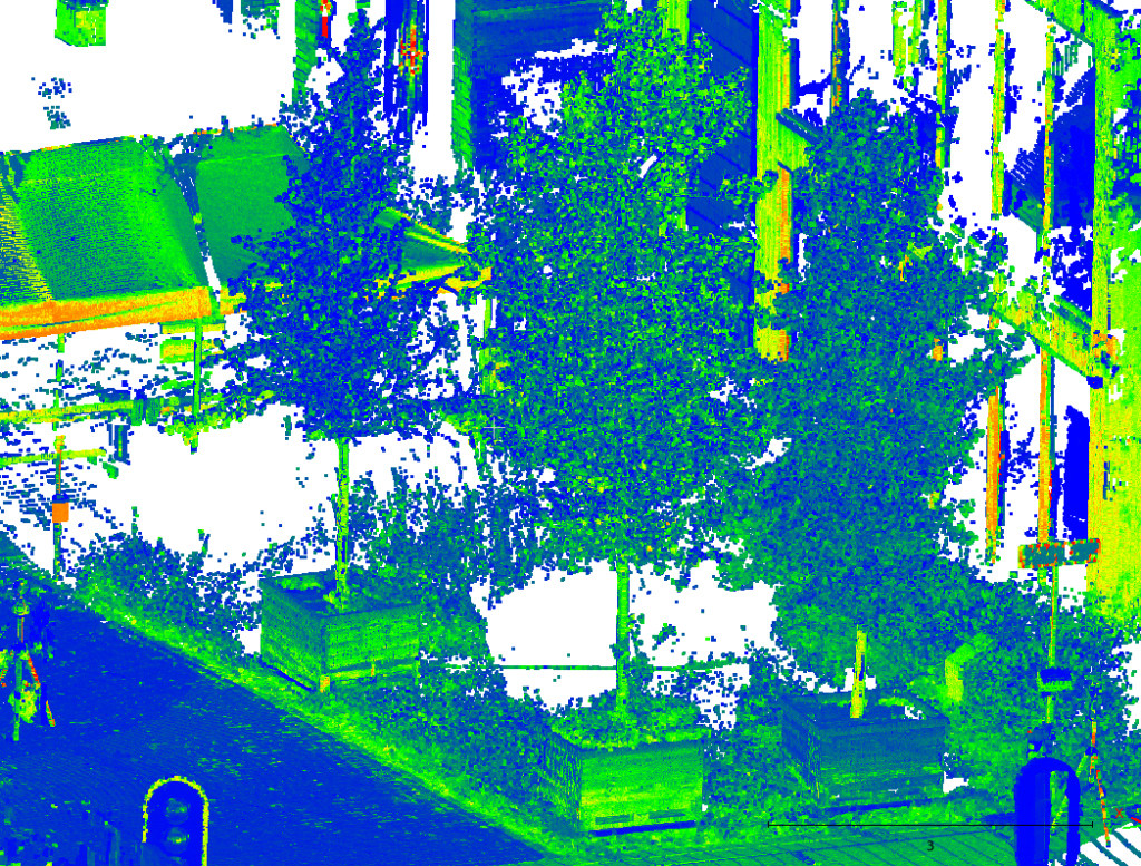
type: Scan of five trees from three angles, and a talud from the opposite side of the water
Associated Project: health monitoring trees green village and talud vegetation
Number of scans: 2
Location on Bulk drive:
\staff-bulk\citg\grs\OLRS\LaserScanner\20250818_greenvillage\talud
\staff-bulk\citg\grs\OLRS\LaserScanner\20250818_greenvillage\trees
Contact person: Daan Hulskemper (d.c.hulskemper@tudelft.nl)
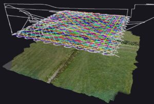
Zandmotor temporal UAV point cloud dataset
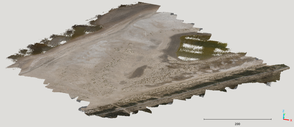
Location + Date: Zandmotor, Monster, (bi-monthly) acquisition between 2023-09-27 and 2024-10-09. The acquisition is ongoing, and the end data will be updated.
Object: Terrain, two polygons, just north of the Schelpenpad, including the ARGUS tower, and the embryonic dune field just south of Schelpenpad. The latter is not in acquired in every epoch.
Associated project: AdaptCoast/Zandmotor
Number of epochs: 9
Flight height: 70 m
Flight speed: 8 m/s
Overlap: 0.5
Location on Bulk drive:
- /staff-umbrella/dronemotor/01_raw_data/drone/{date} < the raw YS, image and GNSS data per epoch
- /staff-umbrella/dronemotor/01_laz_rd/{date} < the processed and transformed point clouds per flight strip and merged per epoch
Contact person: Daan Hulskemper (d.c.hulskemper@tudelft.nl) and Romy Hulskamp (r.hulskamp@tudelft.nl)
Additional info:
Not all the scans are fully processed yet!
IGRS and transponder Zegveld
Location + Date: Zegveld, Utrecht, 31-08-2023
Object: IGRS and Transponder at Zegveld
Associated project: summerschool-zegveld-igrs
Number of strips and flights: 1 flights
Location on Bulk drive: /staff-bulk/citg/grs/OLRS/LaserScanner/0001_UAV_LiDAR/20230831_summerschool-zegveld-igrs/
Contact person: Marijn Brandwijk (M.O.N.Brandwijk@student.tudelft.nl)
High density Zegveld IGRS
Location + Date: Zegveld, Utrecht, 31-08-2023
Object: IGRS Zegveld
Associated project: summerschool-zegveld-igrs
Number of strips and flights: 4 flights at 15m fly height
Location on Bulk drive: /staff-bulk/citg/grs/OLRS/LaserScanner/0001_UAV_LiDAR/20230831_summerschool-zegveld-igrs/
Contact person: Marijn Brandwijk (M.O.N.Brandwijk@student.tudelft.nl)
Tidal flats Waarde
Location + Date: Waarde, Zeeland, 11-04-2023
Object: Tidal flats
Associated project: slik-westerschelde-nioz
Number of strips and flights: 5 flights, Fly heights: 20m, 50m and 70m. 20m flight in grid pattern.
Location on Bulk drive: /staff-bulk/citg/grs/OLRS/LaserScanner/0001_UAV_LiDAR/20230411_slik-westerschelde-nioz/
Contact person: Marijn Brandwijk (M.O.N.Brandwijk@student.tudelft.nl)
Springert dunes
Location + Date: Springert, Zeeland, 15-03-2023
Object: Springert dunes
Associated project: springert-dunes
Number of strips and flights: 5 flights, Fly heights: 30m, 50m and 70m. 30m flight in grid pattern.
Location on Bulk drive: /staff-bulk/citg/grs/OLRS/LaserScanner/0001_UAV_LiDAR/20230315_springert-dunes/
Contact person: Marijn Brandwijk (M.O.N.Brandwijk@student.tudelft.nl)
Veenweide innovation center at multiple fly heights
Location + Date: Zegveld, Utrecht, 06-12-2022
Object: Pasture and IGRS station at Veenweide innovation center
Associated project: innovation-center-zegveld
Number of strips and flights: 1 flight, 10m-100m fly height with 10m intervals
Location on Bulk drive: /staff-bulk/citg/grs/OLRS/LaserScanner/0001_UAV_LiDAR/20221004_innovation-center-zegveld/YS-20221206-150252_export
Contact person: Marijn Brandwijk (M.O.N.Brandwijk@student.tudelft.nl)